
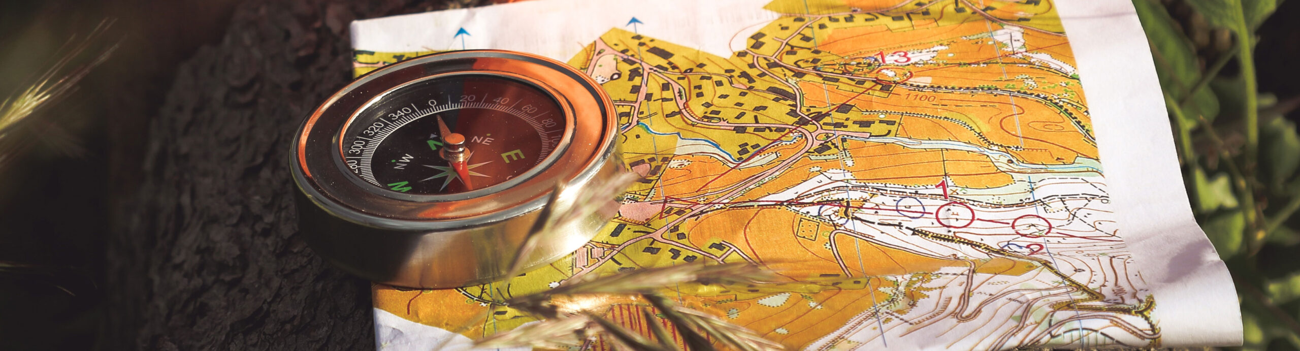
Advanced Training Event
March 20, 2021Samuell Farm North Park, Mesquite
Welcome to Samuell Farm North
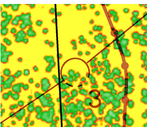
This special event, in the form of a forest sprint-O, will be held using a new specially drawn map of a small area primarily consisting of cedar trees in the northeastern part of the old Samuell Farm, north of US-80 between Mesquite and Sunnyvale. The area is only 0.3 miles wide and ½ mile long. Using laser data we have created a very accurate map at a scale of 1:4,000 where basically every tree is drawn at the correct width. This makes the map exceptionally precise, making it possible to navigate from tree to tree. However, if you lose contact with the map and are not certain of where you are on the map, it is very difficult to relocate your position on the map. This characteristic makes the area and the map a perfect venue to train detailed and advanced navigation on short sprint distance courses.
The area is flat and this time of year it is easy to run in the open grassland between the trees. The map is not drawn according to the ISOM Norm, but it is somewhat similar to the norm we are used to. Yellow is rough open land. Dark green is dense forest however, in most places you will be able to pass slowly through dark green. You can trust the map. It is very accurate. Check out the map snippet below.
Assisted Do-it-Yourself Format
This event will be a limited service event in a format that will follow state and local COVID regulations, adhere to COVID guidance from Orienteering USA, our sport’s national governing body, and hopefully, protect the health of participants and organizers.
The event will be available between 12 noon and 4 pm on Saturday March 20. All courses are difficult orienteering. We encourage that you start running course 1 which is only about 1 kilometer. This will make you familiar with the map and the forest. Following that you are welcome to run as many of the other courses as you like until the event closes at 4pm. You are also welcome to run the same course several times. It will continue to be difficult.
Think of it as a training event. There will be a small staff organizing the maps and giving basic instructions. We will attempt to operate e-punch and print out your times after you finish. There will be no scoring and no awards; just orienteering fun. Bring your own water and gear. Controls will be 3 foot tall stakes with standard O-bags, control number and an e-punch box.
There will be NO BEGINNER (AKA WHITE or YELLOW) COURSES.
Beginners and less experienced orienteers can participate by running/walking the short course alone or with a more experienced runner (ideally a family member or leader) while following safety precaution.
If you get lost go to the North, East or South edge of the forest and find a known location where you can restart your navigation or navigate along the edge of the forest back to the parking lot on the north side of the park. US-80 is south of the forest. You can hear the traffic.
General info
Event Officials
Meet Director: Andrea George/Jens Borsting (no separate Meet Director’s notes, all details are on this page)
Course Setter: Jens Borsting (no separate Course Setter’s notes, all details are on this page)
Courses: Five courses will be offered. All courses will be difficult.
- 960 meters, 6 controls
- 1,600 meters, 8 controls
- 1,600 meters. 9 controls
- 1,700 meters. 10 controls.
- 2,900 meters. 16 controls.
Classes:
N/A — No awards, so no classes.
Scoring: simple e-punch. We will attempt to print and give you your time as you finish. Feel free to post your finishing time and perhaps a screenshot of your marked-up map in our Facebook Group after the event is over!
Scouts: This event has no provision for scout advancements.
Schedule & Instructions
Controls will be in the field before 12 noon on March 20 and we will start to pick up the controls after 4pm on March 20.
INSTRUCTIONS:
- Meet us at the pavilion near the parking lot on the North side of the Samuell North Park near the intersection of East Tripp road and Jobson Road. Fill out the waiver, pick up an e-stick (if you haven’t brought your own) and pick up the map for the course(s) you choose.
- Register with the staff by handing in the waiver and note what course you run.
- Run the course. Find the ribbons. Enjoy.
- After finishing, download the e-punch and get your times printed.
- Optional: Rinse and repeat! Turn in the map from the course you ran and get one for the next course. You’re welcome to do any or all courses and come back as often as you like during the period the ribbons are out.
- Optional: Post your results to NTOA’s Facebook Group. (Join us!)
Event fees
We’re not charging event fees for this training event, but donations are always appreciated! We’re a non-profit organization.
There is no prior registration but if you plan to turn up with a larger group requiring more than 4 maps we would like to know before 5pm on Thursday March 18 so we can have enough maps ready for you. Please text Jens 806 786 8392 or Email jensb@post10.tele.dk Thank you.
Directions
-
The Samuell Farm North Park is located in Mesquite, east of Dallas.
From Dallas: Go east on US-80. About 1½ miles east of I-635 turn North on N. Belt Line Road. Go north ½ mile and turn east on E Tripp road. Samuell Farm North parking lot is 0.8 miles east on E. Tripp Road on the south side.
Parking is limited at the venue (only 19 spaces available). If the parking lot is full you can park on the side of the road on the neighborhood roads, Magic Lane and Manor Way on the north side of E. Tripp Road.